How Many Kilometers is the Delhi-Mumbai Highway?
When you ask, “How many kilometers is the Delhi-Mumbai highway?” the answer has become wonderfully complex, revealing a story of India’s rapid infrastructure transformation. You are likely asking about one of two vitally important routes: the traditional, time-tested National Highway 48 (NH 48) or the game-changing, brand-new Delhi-Mumbai Expressway (NE 4).
The short answer is:
-
The new Delhi-Mumbai Expressway is approximately 1,350 kilometers long.
-
The old Delhi-Mumbai highway (NH 48) is longer, at roughly 1,400 to 1,500 kilometers.
The new expressway doesn’t just shorten the distance; it cuts the travel time in half. This article will serve as your complete guide, breaking down the kilometers, features, and monumental impact of India’s most ambitious roadway.
The Game-Changer: The Delhi-Mumbai Expressway (1,350 KM)
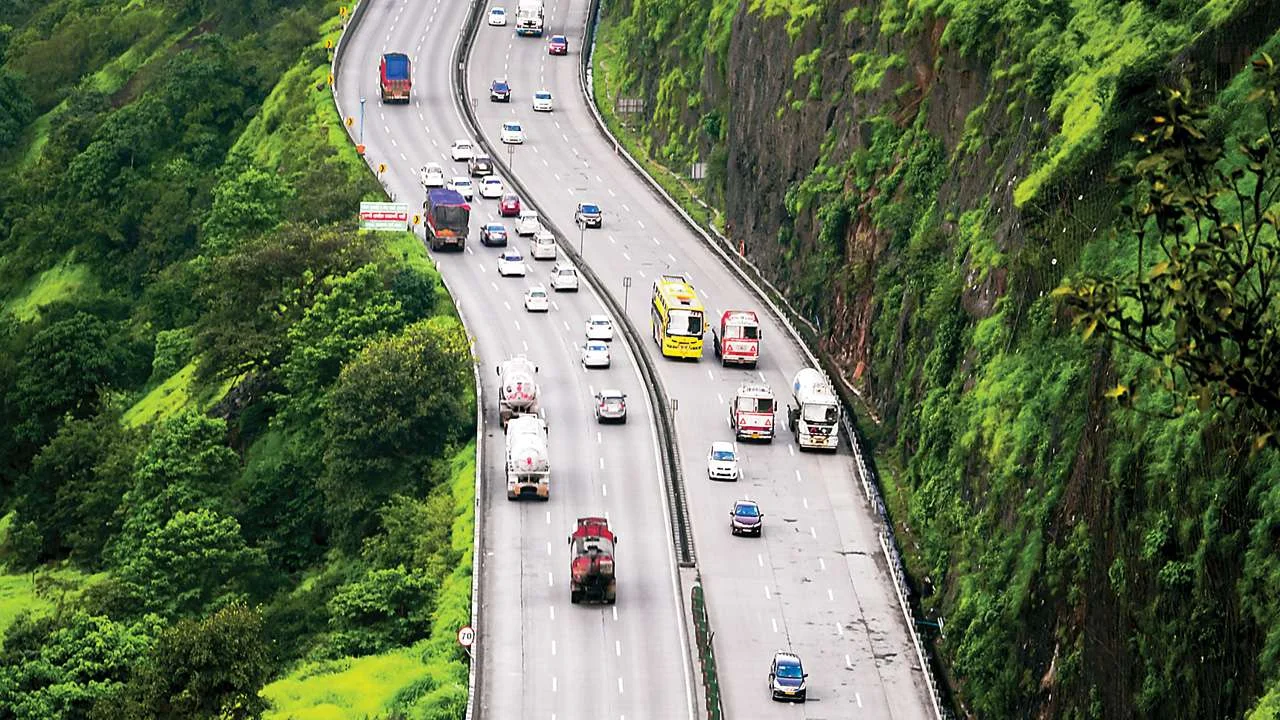
The Delhi-Mumbai Expressway (DME) is the definitive answer to modern-day travel needs between India’s national and financial capitals. This project isn’t just a new road; it’s a revolutionary 1,350 km, 8-lane (expandable to 12), access-controlled marvel of engineering.
Its primary goal is to slash the grueling 24-hour-plus journey by road to a manageable 12 to 13 hours.
Delhi-Mumbai Expressway: Key Statistics
| Feature | Details |
| Total Length | 1,350 km (approx. 840 miles) |
| Lanes | 8 lanes, expandable to 12 lanes |
| Design Speed | 120 kmph |
| Project Cost | Approx. ₹1 lakh crore (US$12.5 billion) |
| Travel Time | 12-13 hours (down from 24-28 hours) |
| Official Name | National Expressway 4 (NE 4) |
| Status (as of Nov 2025) | Partially operational, with multiple sections open |
Route and Kilometers by State
The expressway’s 1,350 km route is a masterclass in strategic alignment, designed to connect major industrial and economic hubs while opening up new corridors for development. It traverses six states:
-
Delhi (NCT): 12 km
-
Haryana: 129 km
-
Rajasthan: 373 km
-
Madhya Pradesh: 244 km
-
Gujarat: 426 km
-
Maharashtra: 171 km
This route is significantly different from the old NH 48, intentionally bypassing crowded city centers. For example, it provides efficient connectivity to cities like Kota, Indore, Vadodara, and Surat without forcing transit through congested urban roads.
Beyond the Tarmac: Key Features of the Expressway
To write 1,500 words on a road, that road must be more than just asphalt. The Delhi-Mumbai Expressway is a showcase of “what’s next” in infrastructure.
-
A “Green” Highway: This isn’t just a figure of speech. The project includes the planting of over two million trees and shrubs.More impressively, it features a rainwater harvesting system every 500 meters and is designed to be powered in large part by solar energy.
-
Asia’s First Wildlife Corridors: In a groundbreaking move for environmental conservation, the expressway is the first in Asia to feature dedicated animal overpasses and underpasses. This includes 4-km-long tunnels through the Mukundra Sanctuary in Rajasthan, ensuring wildlife can migrate without risking a high-speed collision.
-
Unmatched Safety: The plan includes fully-equipped trauma centers and helipads every 100 kilometers for rapid medical evacuation in case of emergencies. The entire 1,350 km stretch is access-controlled, meaning no stray vehicles, animals, or local traffic can unexpectedly enter the high-speed lanes.
-
World-Class Amenities: Forget the old dhabas. The expressway has 94 planned Wayside Amenities (WSAs) that are more like self-contained villages.These will feature food courts, restaurants, motels, petrol pumps, EV charging stations, and even facilities for truck drivers.
-
A “Digital Highway”: The project includes laying a vast network of optic fiber cables, making it 5G-ready. This will power advanced traffic management systems (ATMS), AI-powered surveillance, and automated toll collection, ensuring a smooth, intelligent, and safe journey.
The “Old” Highway: National Highway 48 (NH 48)

Before the expressway, the definitive answer to “the Delhi-Mumbai highway” was National Highway 48 (NH 48). This route is part of the iconic Golden Quadrilateral, the network of highways connecting India’s four major metro cities.
-
Distance: The Delhi-Mumbai section of NH 48 is approximately 1,400 to 1,500 kilometers. (Note: The full NH 48 is much longer, as it runs from Delhi all the way to Chennai, spanning over 2,800 km).
-
Travel Time: Due to its design, this route traditionally takes 24 to 28 hours or more, depending on traffic.
-
The Route: The classic NH 48 route runs Delhi -> Gurugram -> Jaipur -> Udaipur -> Ahmedabad -> Vadodara -> Surat -> Mumbai.
Why is NH 48 So Much Slower?
The new expressway is not just shorter; it’s fundamentally different. The challenges of NH 48 are what inspired the new project:
-
Lack of Access Control: NH 48 is not a sealed expressway. It runs through countless towns and cities, with intersections, traffic signals, and local traffic (like tractors and auto-rickshaws) merging onto the highway.
-
City Bottlenecks: The highway passes directly through or on the outskirts of major, congested cities like Jaipur, Ahmedabad, and Surat. This forces long-distance travelers to navigate dense urban traffic, adding hours to the journey.
-
Variable Road Quality: While large sections are 6-laned and in good condition, the quality can be inconsistent. It is not designed for a sustained, uninterrupted speed of 120 kmph.
NH 48 will remain a vital artery for India, but for the specific task of connecting Delhi and Mumbai, the expressway has rendered it the slower, scenic route.
Head-to-Head: Delhi-Mumbai Expressway vs. Old Highway (NH 48)
This comparison table makes the difference crystal clear.
| Feature | Delhi-Mumbai Expressway (NE 4) | Old Highway (NH 48) |
| Total Distance | ~1,350 km | ~1,400 – 1,500 km |
| Travel Time | 12 – 13 Hours | 24 – 28+ Hours |
| Lanes | 8 (Expandable to 12) | 4 to 6 lanes, variable |
| Access Control | Yes (Fully access-controlled) | No (Multiple entry/exit points) |
| Speed Limit | 120 kmph (designed) | 70 – 100 kmph (variable) |
| Route | Connects industrial hubs (Kota, Indore, Vadodara) | Connects major cities (Jaipur, Udaipur, Ahmedabad) |
| Amenities | 94 modern Wayside Amenities | Traditional dhabas, petrol pumps, city-based hotels |
| Primary Use | High-speed, long-distance travel and freight | Regional and city-to-city connectivity |
The Colossal Economic Impact: Why 1,350 KM Matters
This 1,350-km strip of concrete is far more than a convenience for travelers. It is a core pillar of India’s economic strategy.
-
Logistics & Freight: The expressway is set to be the backbone of the Delhi-Mumbai freight corridor. By cutting travel time in half, it will dramatically reduce logistics costs. A truck that took two or three days for a trip can now potentially do it in under 18 hours, saving over 320 million liters of fuel annually.
-
Connecting Economic Nodes: The route was strategically designed to connect 13 ports, 8 major airports, and 8 multi-modal logistics parks (MMLPs).This integration will make Indian manufacturing and exports more competitive.
-
Real Estate Boom: The expressway is creating new economic centers. Land and property values in previously remote areas along the route in Haryana, Rajasthan, and Gujarat have seen a massive boom, leading to new residential townships, industrial parks, and warehousing hubs.
-
Tourism: The highway will unlock new tourist circuits.It will be easier than ever to plan a road trip from Delhi to destinations like Ranthambore, Jaipur, Kota, Udaipur, and Vadodara, all of which are now just a few hours’ drive from the main artery.
FAQs: Your Questions Answered

Q: What is the exact length of the Delhi-Mumbai Expressway in kilometers?
A: The most widely reported official length is 1,350 kilometers.35 You may also see figures like 1,386 km, which often include extra spurs or interchanges in their calculation.
Q: Is the Delhi-Mumbai Expressway fully open to the public?
A: As of November 2025, the expressway is partially operational.36 Several key sections, such as the Sohna-Dausa stretch, sections in Madhya Pradesh, and the Vadodara-Bharuch segment, are open to the public.37 However, the entire 1,350 km route is not yet complete.
Q: When will the full expressway be completed?
A: While the initial deadlines were set for 2024 or 2025, large-scale infrastructure projects often face delays.38 The full completion of all sections, including the complex final stretches near Mumbai, is now anticipated by 2026 or 2027.
Q: What is the old Delhi-Mumbai highway called?
A: The “old highway” is National Highway 48 (NH 48).
Q: How much distance does the new expressway save?
A: The new 1,350 km expressway shortens the route by approximately 150 to 180 kilometers compared to the old 1,500 km (approx.) NH 48 route. But more importantly, it saves 12 to 14 hours of driving time.
Q: What vehicles are allowed on the Delhi-Mumbai Expressway?
A: As a high-speed, access-controlled expressway, it is built for fast-moving vehicles like cars, buses, and trucks.40 Slower vehicles like two-wheelers (motorcycles, scooters) and three-wheelers (auto-rickshaws) are strictly prohibited for safety reasons.
Conclusion
So, while the simple answer to “how many kilometers” is 1,350 km for the new expressway, the real story is in the “why.” This 1,350-kilometer project redefines the relationship between India’s two most powerful cities.42 It is a testament to engineering ambition, a catalyst for economic growth, and the new benchmark for road travel in the nation. The “highway” of the past, NH 48, remains a useful road, but the “expressway” of the future, NE 4, is the new lifeline.